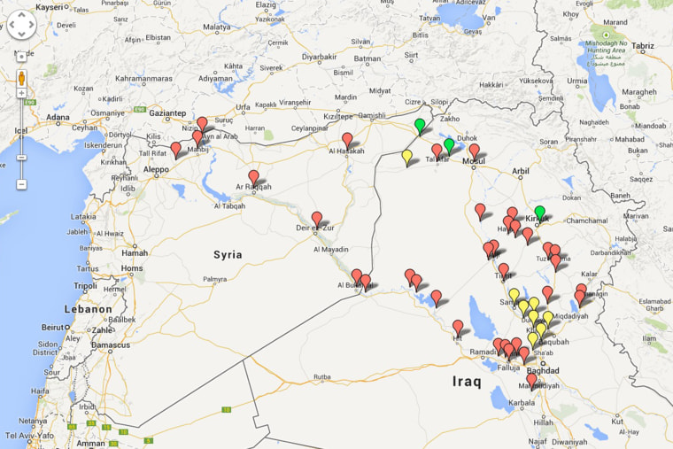
Among helpful guides to developments in the incursion of ISIS into Iraq and Syria, the Guardian is keeping an active live blog (thanks to my colleague Rawan for pointing that out), New York Times offers a typically data-dense scrolling interactive page but if the sudden rush of coverage from Iraq has left your head a jumble of Iraqi place names your brain hasn't touched in years, what's also quite handy is the relative simplicity of Long War Journal's regularly updated Google Map.
Red are cities taken by ISIS, yellow markers indicate where there has been fighting, and green are cities occupied by Kurdish Peshmerga. It only takes one look at the area around Baghdad to understand the alarm there.
Click through to the larger map to see details on the individual points.
