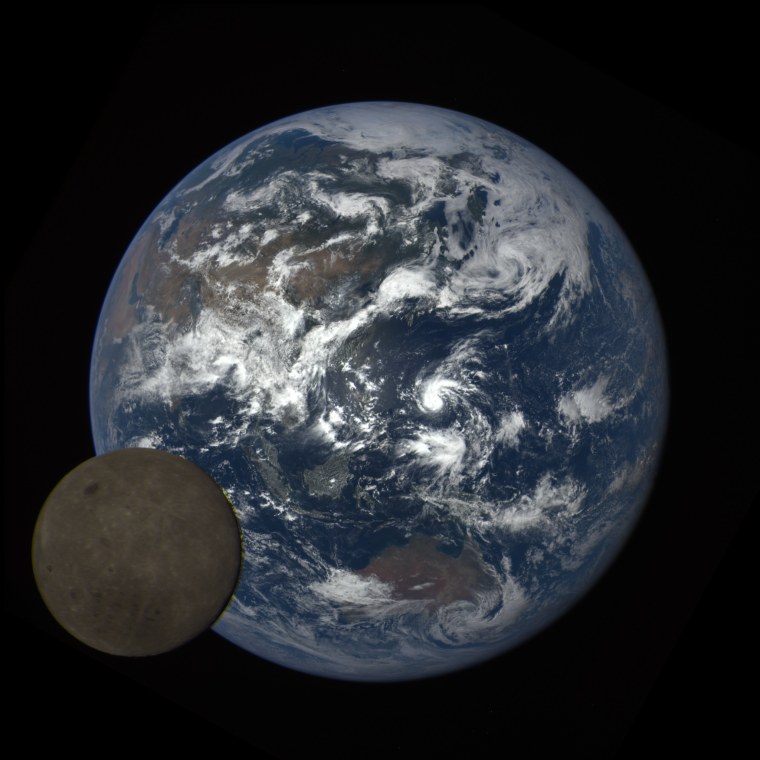
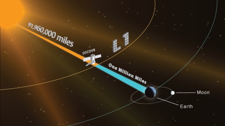
This month NASA released a year-long time lapse of the Earth as seen by its Deep Space Climate Observatory (DSCOVR) mission orbiting the Sun in sync with us.
You may have already seen a few releases from the Earth Polychromatic Imaging Camera (EPIC) camera abroad the spacecraft, most notably its a first-light image last July and earlier this month when the Moon briefly photobombed the Earth.

DSCOVR is over a million miles away from us, but it is able to stay in orbit directly between Earth and the Sun thanks to a gravitational point of stability known as a Lagrange Point, where the pull between two masses is balanced. In the Sun-Earth system, there are five such points - DSCOVR orbits at the first one (L1) which is a point between the Sun and the Earth where the pull of both bodies on the spacecraft is equal. In this position, the side of Earth facing the spacecraft is always fully illuminated by the sun. DSCOVR's mission is to observe the solar wind (aka space weather) and provide advance warnings when magnetic storms and flares are headed our way, but its unique vantage point also enables it to provide valuable data on Earth's atmosphere and climate.

For the past year, EPIC has taken a photo of Earth every two hours which NASA has now used to create a time-lapse video. EPIC has ten different filters, but only a subset of them (red, green, and blue) were used to create these images. The video below is narrated by Jay Herman, the lead scientist on EPIC, who explains the mission while the Earth goes through a full year. It's fascinating to pick a hemisphere or latitude and see how the cloud cover changes (or doesn't) day to day and month to month.
Here's some more geek from the week:
- Check out these beautiful portraits of primates by Polish photographer, Paul Bogumil.
- Ancient crocodiles may be responsible for an unusual concentration of fossilized birds' feet.
- A patient in the UK has just undergone their first double hand transplant surgery.
- New simulations show that the continents accelerated away from each other at rates comparable to how fast your fingernails grow (which is fast for a ginormous landmass...) [VIDEO]
- Doodles in Leonardo Da Vinci's notebook turn out to be his first inklings of the laws of friction.
- If the daily grind is getting you down, celebrate living in the future with at least six technologies from the Star Trek universe.
- This solar powered airplane just completed record-making trip around the world.
- NASA is finally digitizing the data from the Viking lander on Mars which has survived solely on microfilm for the past forty years.
- Lowell Observatory is running a Kickstarter campaign to help restore the telescope Clive Tombaugh used to discover Pluto.
- The German Aerospace Center (aka DLR) is collecting goodbye messages for the Philae lander which they will lose contact with shortly.
Keep on geeking!
—@Summer_Ash, In-house Astrophysicist
