As we all sit in front of our TVs watching the giant red pinwheel spin endlessly up its cone of projection, NASA has an interesting, different way of rendering the storm's features and strengths on the Irene portion of their Hurricanes/Tropical Cyclones blog.
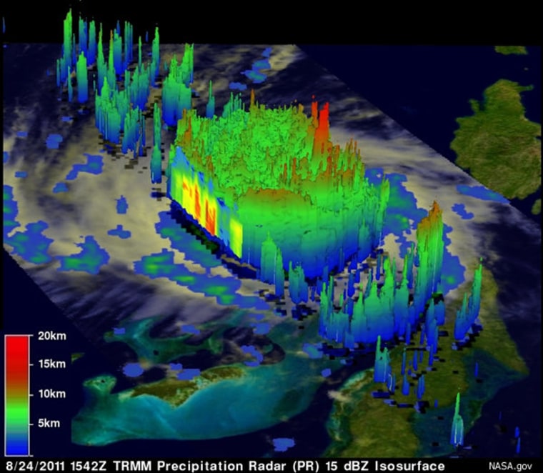
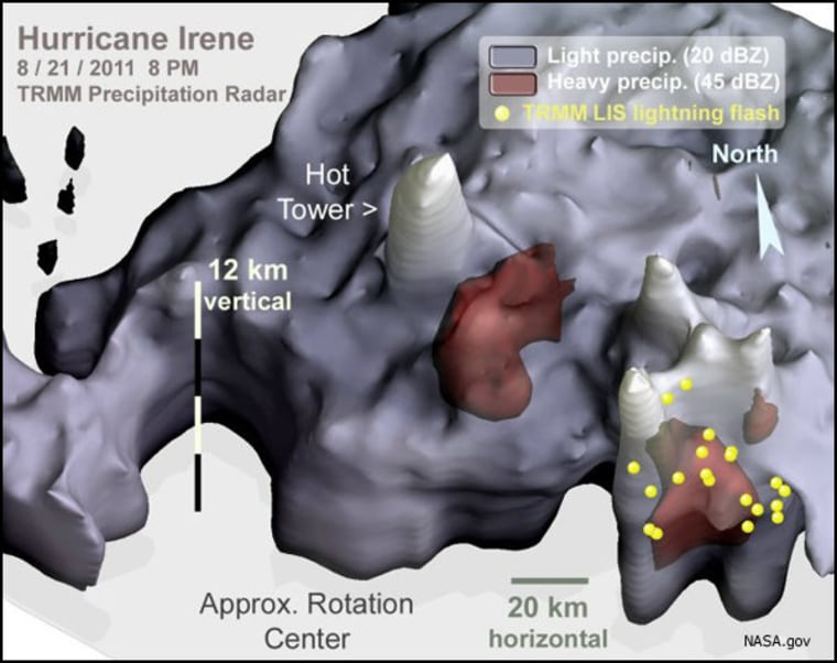
The Tropical Rainfall Measuring Mission (TRMM) satellite radar takes a 3-D picture that shows not only intensity but height.
Unfortunately, as far as I can tell, the images are subject to the satellite's orbit, so it's not like they're able to fly over the storm whenever they want to gather new data. Still, I've been watching storm coverage and updates for hours this morning and I don't think I've heard anyone report that "the highest towering thunderstorms were about 7.5 miles high" on Friday.
A different rendering of TRMM data:

"Another 3-D view of Irene was captured on August 24 the storm, revealed once again the presence of a deep convective tower within the eyewall. The red area indicates rainfall rates of 50mm/hr (~2 inches), while yellow and green areas indicate moderate rainfall between .78 to 1.57 inches (20-40 mm) per hour."
